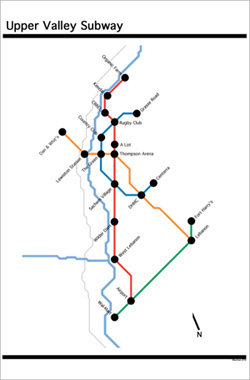
Inspired by Transit Authority Figures (see the Daily Hampshire Gazette), as well as my beloved Metro and of course Advance Transit, here’s a mockup of a map for a Hanover-area subway system (pdf).
————
[Update 08.06.2016: Thayer School Dean Robert Fletcher “drew up plans in 1899 for a subway line running between Hanover and White River Junction” (Lee Michaelides, “In the Beginning,” Dartmouth Engineer Magazine).]